Monday, October 29, 2018

Mosaic!

After flying over penguin colonies to take pictures of them, the first step in our analysis is to stitch together the (sometimes hundreds of) photos into a single mosaic. Here is a mosaic from our first (and so far only) flight over the Cape Crozier colony this season.
ACA #2019-006
The next step in our workflow is counting every single penguin in the image.  We counted about 1550 penguins in this mosaic!

ACA #2019-006

Stormy!


Over the weekend we had rough weather conditions with gusts over 60 knots ! Of course we did not fly in these conditions; we were spending time inside the lab working in our data!


Thursday, October 25, 2018

Take off!


ACA #2019-006
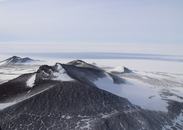
Yesterday we took our first survey flight over an emperor penguin colony! The sunny skies and (relatively) low winds were perfect for helicopter flight. From McMurdo, we flew past Mt. Erubus, along the coast to Cape Crozier. 


Cape Crozier is famous for a few reasons. First, it is home to a massive Adélie penguin colony that continues to be studied extensively (check out www.penguinscience.org for more info on that). Second, it is a historic site that was initially landed by humans in 1902 during Captain Scott’s Discovery expedition. Third, and most importantly for our project, it is home to one of the southernmost emperor penguin colony in the world!


Weirdly, the colony itself is wedged in the fast ice within a massive crack in the ice shelf. This is a bit unusual for emperor penguins – most are located on relatively flat swaths of sea ice. Yet, from a distance we could see the unmistakable signature of an emperor colony: the darkened patch of guano left by hundreds of penguins, sharply contrasted against the pristine white ice.

The two black spots are the colony. ACA #2019-006
We took several passes in the helicopter at a safe distance, carefully photographing the colony from every angle.

ACA #2019-006
You can see the tiny chicks, black and white on this image! ACA #2019-006

 ACA #2019-006

ACA #2019-006
ACA #2019-006
ACA #2019-006
With hundreds of images saved, our next goal is to pick through the images and count every single bird!

Tuesday, October 23, 2018

Training, briefing, testing, walking around!


Today we tested our cameras from the mountains above McMurdo - as we write this, our computers are stitching together a beautiful mosaic of the station. We also met with the Basler and helicoper teams that will be in charge of our operations. Everyone is eager to get up in the air!

Yesterday was really cold. With the wind chill, the temperature was -42 degree F with wind gusting to 40 knots. It's amazing to think this is the beginning of the Antarctic summer.


We also went through mandatory training that is essential for our work in Antarctica, including safety, rescue, vehicle, and environmental training. 
Here is the team in action during the survival training
On Sunday night, we went for a small hike up to the kiwi (New Zealand) base about 45 minutes away from McMurdo station. The light was amazing and we were lucky enough to see (and distantly hear) some Weddell seals - though we weren't close enough to get any good photos!

The last sunset

Sunday, October 21, 2018

Frozenly arrived!

McMurdo Station: wind chill -32°C and -26°F, 20 knots wind.

After our "ice flight" was delayed by three days (caused by bad weather at the McMurdo station airfield), we departed Christchurch yesterday. We lucked out and had the luxury of flying to Antarctica on an Airbus (complete with in-flight coffee, meal service, passenger seats, and windows), instead of the typical military C-17 that lacks passenger windows. Our flight took us over sea ice, across the trans-Antarctic mountains, past Mt. Erebus (an active volcano), and finally to the McMurdo ice runway.


The arrival
We started our field season by attending introductory briefings, touring the base, and finding our temporary office.

The team!

View from the base
McMurdo Station
To stretch our legs after the 5-hour flight, we took a short walk through town to the historic Discovery Hut. This wooden building was erected in 1902 by the British as a shelter and storage facility suitable for Antarctic climatic conditions. They intended to use the base for the Discovery Expedition lead by Sir Robert Falcon Scott. Unfortunately, the hut was unbearably cold and windy - so much so that the crew refused to use it and continued sleeping on the ship or in tents outside!  

The Discovery Hut
We then ended our first night in Antarctica by watching the sun set behind the distant Mount Discovery. This will be the one of the last sunsets before McMurdo experiences 24-hour daylight during the Antarctic summer.

On Sunday morning we had the legendary "Sunday brunch" and started to plan our fieldwork… In the coming days, we will go through a series of additional training exercises that will prepare us to fly over the ice - and find the emperor penguin colonies! 


Tuesday, October 9, 2018

Here we go!

The project in a nutshell!

The emperor penguin is an iconic seabird, found in colonies distributed around the entirety of the Antarctic coastline. They breed on the Antarctic sea ice during the incredibly harsh winter and rely on fast ice (sea ice physically adhered to land) for the majority of their life cycle. Low sea ice extent reduces the availability of breeding sites and food. High sea ice extent causes longer foraging trips for parents to reach areas of open water, and hence decreases the food delivered to the chicks. As such, they are susceptible to environmental change, such as decreases in the extent and duration of sea ice around Antarctica.


Using satellites, ground and flight/helicopter survey estimates, the goal of our project is to generate population estimates for every colony of emperor penguins (54 are known currently) over the course of 10 years. The project is led by Michelle Larue (University of Minnesota, and Stephanie Jenouvrier (Woods Hole Oceanographic Institution).

Locations of known breeding colonies (yellow dots; n=54) of emperor penguins in Antarctica; VHR satellite image (courtesy DigitalGlobe, Inc.), and aerial image (from helicopter/flight) illustrating emperor penguin colony.
Researchers will also integrate the population trends with environmental variables (e.g., sea-ice extent and duration) to learn about conditions that may influence population and whether those fluctuations are global or regional in nature.

Our fielwork!

We will be a team of four scientists deploying to McMurdo Station in mid October, where we will remain for four weeks. McMurdo Station is based in the Ross sea in Antarctica. The team is composed of Michelle Larue, Leonardo Salas, Dave Iles and Sara Labrousse.

Map of Antarctica with McMurdo station,
© Geographic Guide - Antarctic - Image of the Globe.

Our mission will be to fly aerial surveys over near-station emperor penguin colonies within the vicinity of the station, including one Basler aircraft flight covering Beaufort Island, Franklin Island, Cape Washington, Coulman Island, and Cape Roget; and up to four helicopter flights over Cape Crozier and possibly Beaufort Island. During surveys, we will take photographs through the windows and record bird counts.

Sites we will fly over using Basler aircraft or helicopter.